In the initial phase of the scenario, the conductor hands the topographic maps to the participants inviting them to observe and try to interpret the morphology maps represent. He then illustrates to the participants the meaning of the graphic elements that characterize the map and, in particular, of the contour lines that define the morphology of the represented territories.
Another important issue is the scale of the map, so the explainer after he will have explained this concept and the mathematical procedures to convert the lengths on the map to the real ones and vice-versa, he will list the most usual scale ratios used on topographic maps. Then the conductor will provide each participant with a photocopy reproducing just one contour line from the topographic map (in our case just eleven contour lines define the whole territory, so the ideal number of participants is 11 or 22, but also a different number works considering the same person could cut more than one contour line).
Each participant should place the photocopy on a polystyrene sheet of the appropriate size, and puncture the contour line crossing both the photocopy and the polystyrene sheet. Once the operation is completed, a die-cut will be obtained on the polystyrene sheet that will allow you to detach the portion to be used from the rest.
It is important that two corresponding reference points are marked within each contour line in order to subsequently overlap the pieces of polystyrene sheet correctly.
Once the participants have finished this operation, they will superimpose the polystyrene portions on each other in progressive order from the lowest to the highest level. Two toothpicks arranged vertically in correspondence with the two reference points will allow the portions to be overlapped correctly, so as to reproduce the real morphology of the territory represented on the topographic map.
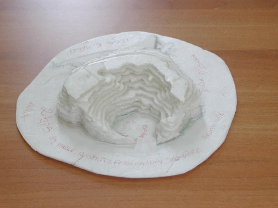
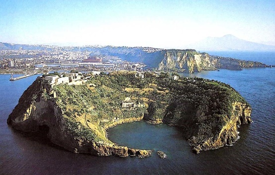
The model gathered after the scenario (above) and an aerial photograph of the real territory (below)
The attached .PDF file provides with the topographic map and the sheets with the single cotour curves of Nisida, a small island in the surroundings of Naples